@KSLcom reporter covering outdoors, history, transportation & #SLC. Also here for nature, weather & sports | Tweets don't represent the opinion of KSL.
Construction starts on the sports, entertainment, culture and convention district next year.
We want a strong LOCAL vibe in addition to iconic brands. Take the survey and let us know what local restaurants and shops you want to see in the District.
qualtrics.teamseg.com/jfe/fo…
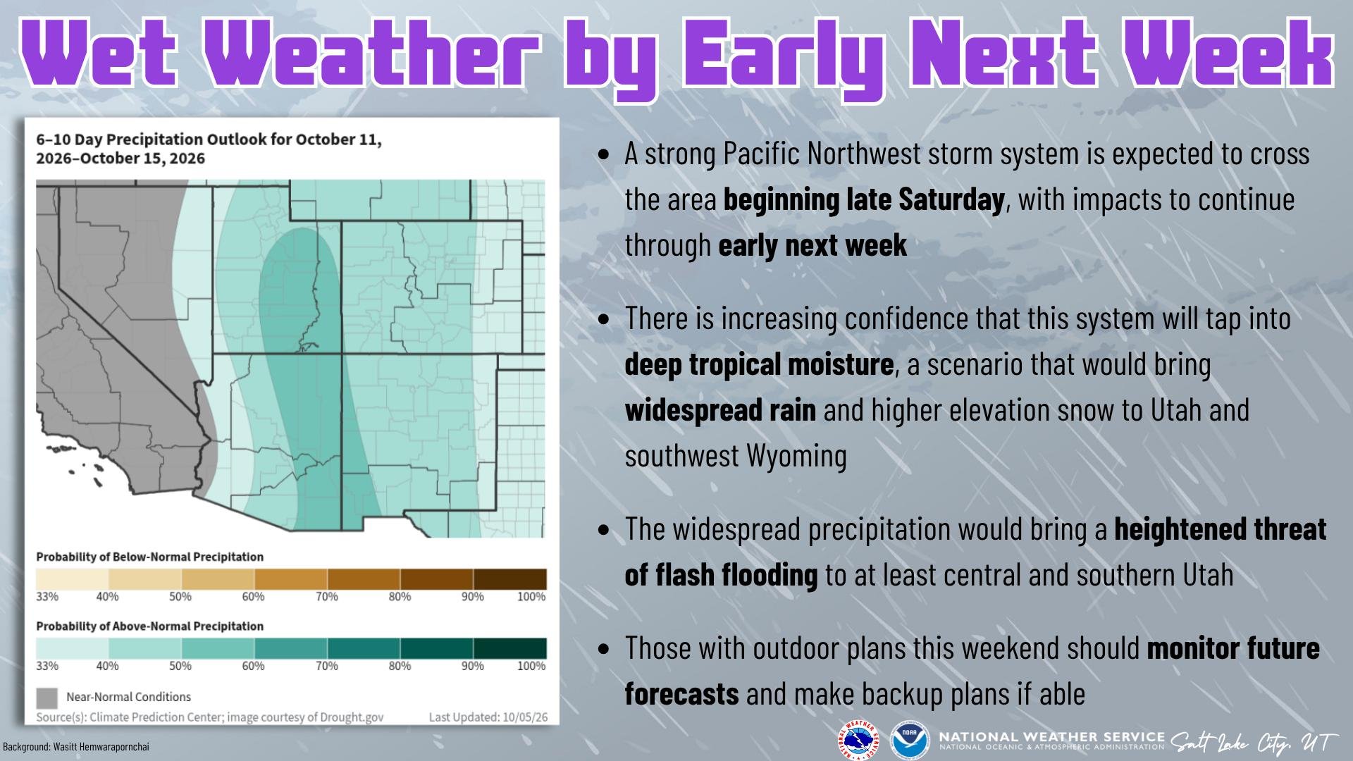
Tropical moisture will interact with a strong PNW system to bring widespread rain (snow >9,000 feet) to Utah and southwest Wyoming late Saturday through at least Tuesday. This will bring a heightened threat of flash flooding to at least central and southern Utah. #utwx#wywx
ALT An NWS graphic titled "Wet Weather by Early Next Week." Background photography by Wasitt Hemwarapornchai depicts raindrops streaming across a glass panel.Key Forecast Messages:A strong Pacific Northwest storm system is expected to cross the area beginning late Saturday, with impacts to continue through early next week. There is increasing confidence that this system will tap into deep tropical moisture, bringing widespread rain and higher elevation snow to Utah and southwest Wyoming. Widespread precipitation brings a heightened threat of flash flooding to at least central and southern Utah. Those with outdoor plans this weekend should monitor future forecasts and make backup plans if able. Outlook Map Details:
An inset map shows the Climate Prediction Center 6–10 Day Precipitation Outlook (October 11–15, 2026, updated 10/05/26), highlighting a 50%–60% probability of above-normal precipitation across Utah and surrounding Intermountain West states.
Up at Deer Valley this afternoon for the “ribbon cutting” of the new Anchor Trees trail, a relatively short hiking only trail (1.3 miles) near Montage but it also connects to all the hiking trails near Empire Canyon and Bloods Lake, making it a key connector for a busy area
"It was really, truly strange."
Utah's 2026 water year ended last week. Statewide mountain precip throughout the year was 96% of normal, but experts point out that nothing else about the year was normal... leaving many questions for 2027 #utwx:
ksl.com/article/51632628/uta…
Those with outdoor plans this weekend should keep a close eye on the forecast. A PNW storm system is expected to cross the area late Saturday into early next week, and there's increasing confidence that it will tap into tropical moisture, bringing widespread precipitation. #utwx
ALT A graphic from NWS Salt Lake City, UT titled "Wet Weather by Early Next Week." Background photography by Wasitt Hemwarapornchai depicts raindrops streaming across a glass panel.Key Forecast Messages:A strong Pacific Northwest storm system is expected to cross the area beginning late Saturday, with impacts to continue through early next week. There is increasing confidence that this system will tap into deep tropical moisture, bringing widespread rain and higher elevation snow to Utah and southwest Wyoming. Widespread precipitation brings a heightened threat of flash flooding to at least central and southern Utah. Those with outdoor plans this weekend should monitor future forecasts and make backup plans if able. Outlook Map Details:
An inset map shows the Climate Prediction Center 6–10 Day Precipitation Outlook (October 11–15, 2026, updated 10/05/26), highlighting a 50%–60% probability of above-normal precipitation across Utah and surrounding Intermountain West states.
Apollo Burger is out at 400 South and Main. It’s a damn shame, Apollo burger SLAPS. they’re nearly done with the courthouse remodel and having that operational will be a gamechanger for the lunch crowd on that block. #slc
Know before you fly! There have been 82 reported drone incursions in 2026. When a drone flies near a wildfire, firefighting aircraft may be forced to shut down operations, delaying suppression efforts and disrupting aviation support for firefighters on the ground.
The preliminary damage survey results are available for the Davis / Morgan County tornado that occurred on 9/18/2026. The tornado reached a peak intensity of EF-2, tracked nearly 6 miles, and reached a peak width of 1.1 miles through steep terrain. More: weather.gov/wrh/TextProduct?…
Delta Center update: The fencing outside of the plaza is gone. The lighting inside the logo statues appear to also be getting a tuneup before the arena reopens for events this weekend