

Breaking News 🔥 Photographer/Videographer Team RMGNews 🎥
- Tweets 24,038
- Following 431
- Followers 66,235
- Likes 69,420


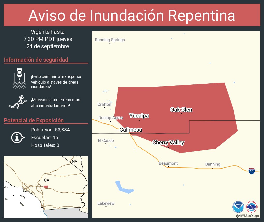
ALT Este gráfico muestra la localización en el mapa de un aviso de inundación repentina. El aviso estará en efecto hasta las 7:30 PM PDT. El aviso incluye a Yucaipa CA, Calimesa CA, Cherry Valley CA. El aviso incluye el condado de Riverside en el sur de California y el condado de San Bernardino en el sur de California. ¡Evite caminar o manejar su vehículo a través de áreas inundadas! ¡Muévase a un terreno más alto inmediatamente! Hay 53,884 personas bajo este aviso incluyendo 16 escuelas y 0 hospitales.


 Andy Mac


ALT SCFoD Emergency responders in protective gear work to rescue individuals from an overturned vehicle next to a road barrier. A graphic at the bottom reads, "Happy Labor Day, United States of America.


 OCFA
OCFA


